

Map 2015
🗺️
Mulakulam Grama Panchayat
Basic Geographical Information - 2015
Mulakulam Grama Panchayat, situated in the north-western part of Kottayam District, is an important Local Self Government Institution implementing various development activities in the social, economic and environmental sectors. The Panchayat is located in Vaikom Taluk and functions under the Kaduthuruthy Block Panchayat.
Geographical Information
📍 District
Kottayam
📍 Taluk
Vaikom
🏢 Block Panchayat
Kaduthuruthy
📐 Area
26.15 Square Kilometres
🏘️ Revenue Villages
Mulakulam, Kaduthuruthy
🔢 Number of Wards
17 Wards
Geographical Boundaries
⬆️ North
Piravom Municipality
⬇️ South
Neezhoor and Kaduthuruthy Grama Panchayats
➡️ East
Elanji and Neezhoor Grama Panchayats
⬅️ West
Thalayolaparambu and Velloor Grama Panchayats
Ward Map
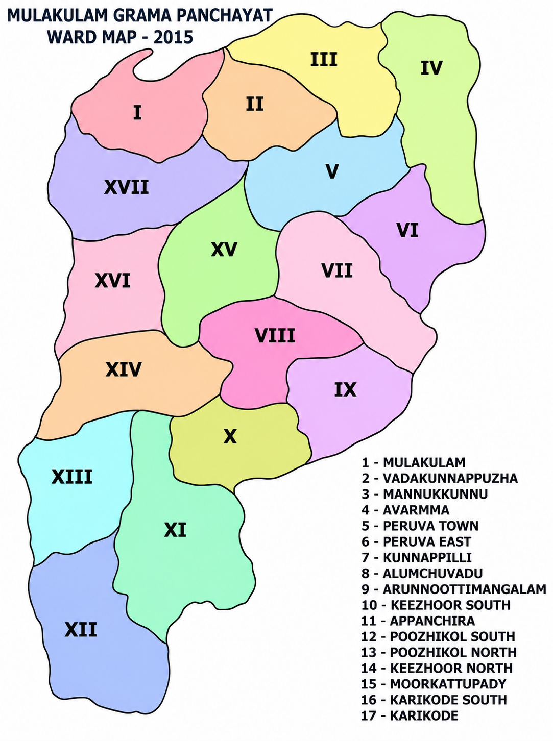
Geographical Map Showing the Wards of Mulakulam Grama Panchayat
List of Wards
01
Mulakulam
02
Vadakunnappuzha
03
Mannukunnu
04
Averma
05
Peruva Town
06
Peruva East
07
Kunnappally
08
Alumchuvadu
09
Arunnootimangalam
10
Keezhoor South
11
Appanchira
12
Poozhikol South
13
Poozhikol North
14
Keezhoor North
15
Moorkattupady
16
Karikkode South
17
Karikkode


